Automated Transit Stop Inventory Management (ATSIM) is a user-friendly web-based system designed for the efficient collection, analysis, update, and management of standard transit stop inventories for transit agencies. It is designed to keep track of transit stop facilities and their amenities. It automates the data collection and analysis process and avoids time-consuming manual data entry and duplication of records by individual agencies. The data collection component of ATSIM consists of a web and ATSIM device tablet interface that can be accessed wirelessly. It is designed to run on a device that has a camera, internet access, and a Global Positioning System (GPS). The system has the capability to store multiple pictures in the database and allows collection of over 100 standard attributes, user-defined fields, and GPS coordinates.
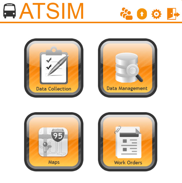
The ATSIM main menu consists of four components:
- Data Collection: Allows collection of over 100 standard attributes, user-defined fields, and GPS coordinates in latitude and longitude.
- Data Management: Allows users to export data and pictures, view and print reports, and generate queries and charts.
- Maps: Allows users to view and print the current transit stop map using Google Maps.
- Work Orders: Allows planning staff to communicate with maintenance personnel to carry out fieldwork related to transit stops.
Major ATSIM Features
ATSIM Version 7.0 provides the following major features:
- Access through a web browser with no software installations.
- Collection of over 100 standard transit stop attributes, including GPS locations, and digital photos.
- Customizable fields and selection items.
- Easy GTFS import of stop IDs, stop locations, stop names, routes, time points, etc., with regular update and rollback capabilities.
- Complete user account management with privileged access control.
- Google Maps visualization of stop locations, stop attributes, and transit routes.
- Generating stop maintenance work orders and tracking fieldwork progress.
- Easy updates of existing stop and work order records in the field or in the office.
- Tracking data update history.
- Export data to CSV, GTFS, GIS, and ZIP files.
- Create, view, and print work orders and reports.
- User-friendly queries and charts.
Please contact Dr. Albert Gan for more information.


 ATSIM User's Guide